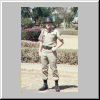
Kagnew Station's main gate. |
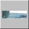
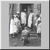
Haile Selassie I Secondary School. |
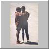
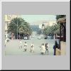
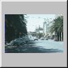
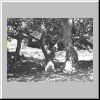
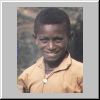
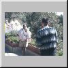
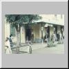
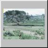
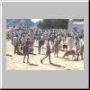
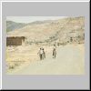
Boys on an Asmara street. |
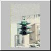
The green was red! |
The red was green! |
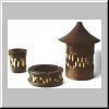
Match holder, ashtray, and cigarette box. |
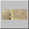
Menelik's story on an Ethiopian Airlines ticket envelope. |

Carved gazelles. |
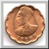
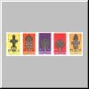
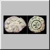
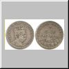
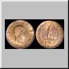
Twenty five cents (ten cents American). |
Twenty five cents (ten cents American). |
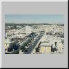
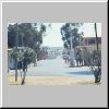
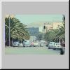
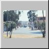
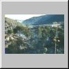
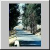
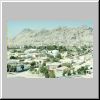
Looking southwest down Queen Elizabeth II Avenue from the Nyala Hotel. |
The old Fiat dealership during day and night (from 200 Pagine Sull'Eritrea, 1952). |
The old Fiat dealership during day and night (from 200 Pagine Sull'Eritrea, 1952). |
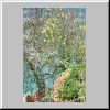
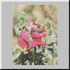
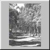
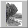
Flowering tree in Asmara. |
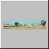
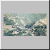
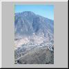
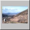
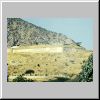
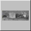
Kagnew Station in the distant center left. |

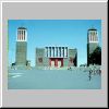
Saint George's church. |
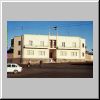
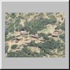
Ethiopian Army Second Division buildings. |
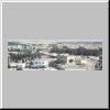
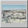
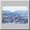
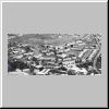
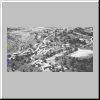
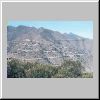
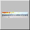
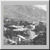
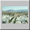
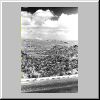
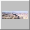
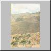
Asmara northeast from the Nyala Hotel. |
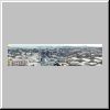
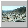
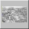
Asmara, north and east from the Nyala Hotel roof. |
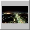
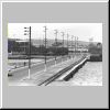
Queen Elizabeth II Avenue at night.
| 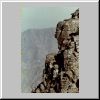
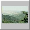
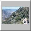
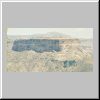
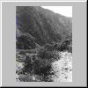
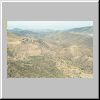
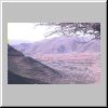
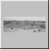
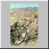
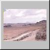
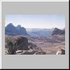
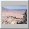
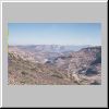
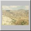
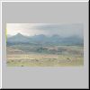
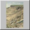
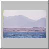
The edge of the Great Rift Valley east of Asmara.
|
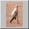
Legless in Asmara. |

"You wanna ride?" |

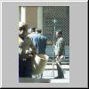
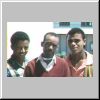
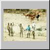
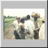
Diverse citizens of Asmara going about their business. |
Diverse citizens of Asmara going about their business. |

Diverse citizens of Asmara going about their business. |
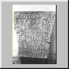
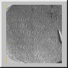
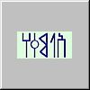
South Arabian writing. |
South Arabian writing. |

South Arabian writing. |
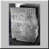
South Arabian writing. |
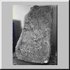
South Arabian writing. |
South Arabian writing. |
South Arabian writing. |
South Arabian writing. |
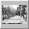
Haile Selassie I Avenue. |

Asmara south of Haile Selassie I Avenue. |
The rougher Asmara north of Haile Selassie I Avenue |
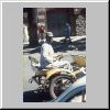
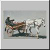
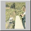
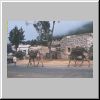
A Gari cart driver. |
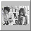
Ma and Pa. |
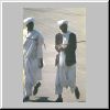
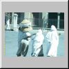
Muslim business men. |
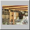
Umbrellas at the Cafe Royal. |
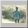
A street vender we called the Spear Man. |

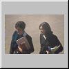
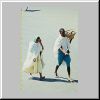
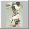
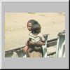
A school girl with her lunch bowl. |
Haile Selassie I Avenue. |
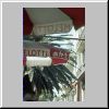
My camera and Coca-Cola Asmara style. |
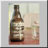
Melotti beer. |
Kids in front of a bookstore. |
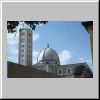
St. Joseph's Catholic cathedral. |
St. Joseph's Catholic cathedral. |
Looking back west up Haile Selassie I Avenue. |
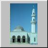
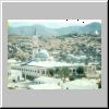
The Grand Mosque. |
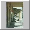
A covered walkway in front of some stores. |
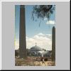
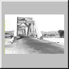
The gateway to St. Mary's of Zion Church. |
St. Mary's of Zion church. |
St. Mary's of Zion mosaic. |
The modern Abuna Teclehaimanot School. |

Deep in the native market near Saint Mary's Ethiopian Catholic Church. |
An injira basket walking away |
St. Mary's Ethiopian Catholic Church |

St. Mary's and St. Joseph's across the Bosch
from northern Asmara. |
My ride home. |
The ASA's Kagnew Patch. |
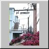
Kagnew's 1th Street. |
Tract E. |
Tract A. |
Tract C. |

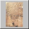
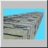
Stonehouse. |
STRACTCOM. |
TTU Hotel in Massawa. |
Keren Rest Center bar. |
One-time Ghinda rest center. |
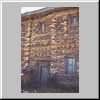
The back of the Tract E barracks. |
Ner, Tesfai, and Girma, our houseboys. |
Kagnew color. |
Kagnew color. |
Kagnew color. |
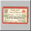
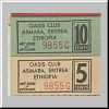
My first Oasis Club card. |
Chits--small change. |
The book with the small change. |
A cross section of the cars we drove. |
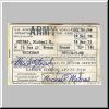
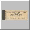
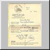
And our license to drive. |

Tract C seen across the top of the buildings of Tract E. |
Tract C and it's antennas. |
Mr. Tulli's apartment building--my home for six months. |
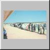
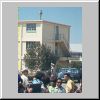
HIM Haile Selassie I arriving through Kagnew's front gate. |

HIM and all the appropriate dignitaries and guards in front of a barracks. |
Guards even man the roof for HIM. |
One dutiful guard. (Better you than me, Denis.) |
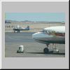
We are leaving! |
Even happier to leave!
|
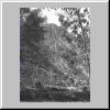
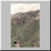
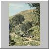
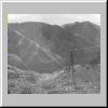
Python Valley. |
The road dropped down and out. |
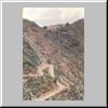
The winding road. |
A look back at the Dorfu Bar. |

The road back up the path. |
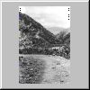
The road on down into the valley. |
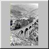
The railroad bridge far above. |
Looking down from The railroad bridge far above. |

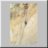
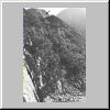
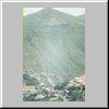
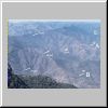
The mountain side seemed to be billowing up like a thunder cloud. |
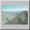
The road was recognizable only as a cleared geometric line. |
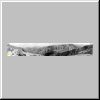
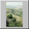
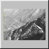
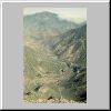
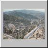
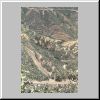
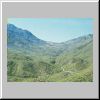
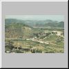
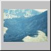
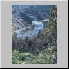
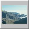
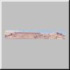
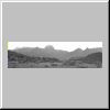
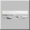
A north to south panorama into Python Valley. |
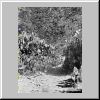
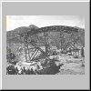
A resting place. |
The new narrow road. |

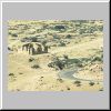
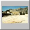
The village of Dorfu. |
And then there was a real road. |
Young eucalyptus trees lined the road. |
A pipe dropped water into a turbine station. |
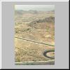
The road between Asmara and Nefasit from above the road's 5 K marker. |
Welcome to the Eritrean Highlands. |

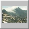
During the rainy season clouds flowed in from the Red Sea. |
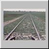
Tracks came in five layers here. |

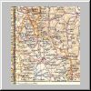
Road map and railway profile between upper Mai Hizni valley and Arbaroba. |
Photographing a proud passerby at the Dorfu bar. |
Road below Dorfu Bar. |

A speeding board and a couple cows. |
A woman carrying a full basket. |
Morning in Arbaroba during a wetter season. |
Railroad crossing road in Arbaroba. |
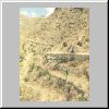
Home site in a valley far below Arbaroba. |

A donkey. |
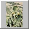
Prickly Pears loaded with beles. |
The world from above Nefasit. |
Nefasit and Mt. Bizan from the road. |
Several views of the road above Nefasit. |
Sisal terraces above Nefasit. |
Morning in Nefasit from the window of the train. |
Road and railroad together below Nefasit. |
A victim of war or of bandits? |
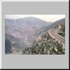
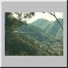
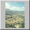
Nefasit Valley from below |
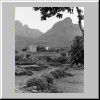
A nomadic family's homestead in the lower end of the valley. |
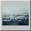
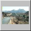
Embatkalla valley with Ghinda in the distance. |
Ghinda. |
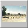
Farms just south of Nefasit. |

Road passing to the south of Nefasit as another goes straight away into a mountain valley. |
Mountains south of Nefasit. |
Entering a long, flat valley. |

A home on a rock. |
An abandoned guard house. |
Looking back across the valley. |
Looking farther back across the valley. |
A similar view on another day with a different film. |

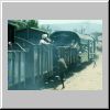
The third class train rounding the mountain above Python Valley. |
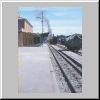
Asmara station. |
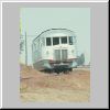
Littorina. |

Littorina interior. |
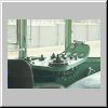
Littorina controls. |
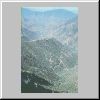
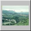
Mai Hizni Valley and beyond. |
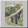
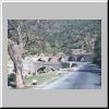
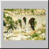
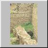
A beautiful stone bridge. |
The stone bridge animated. |
Early morning Dorfu (Python) Valley. |
"We headed back ... below where we had been only a short time before." |
Dorfu Station and its eucalyptus
trees. |
Tracks come in five layers here. |
Littorina above Arbaroba. |
Working up to Dorfu Station. |
Arbaroba from far down the road. |
A departing third-class train. |
Morning clouds below Arbaroba. |
Much the same view on a clear day. |
Road and railroad routes above Nefasit. |

Railroad route into Nefasit from lower down on Debra Bizan. |
Camels passing through Nefasit. |
Road and railroad below Nefasit. |
Above Ghinda. |
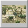
Ghinda station. |

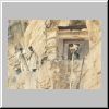
Lost at Ghinda Station? |
Puffed wheat for sale. |
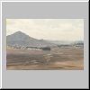
Damas valley flats. |

A goat in the Mai Atol station. |
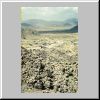
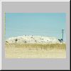
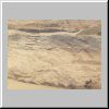
The desert scrubland. |
A long bridge over an almost always dry river. |
Train crossing the same bridge on the back of the new Eritrean ten Nakfa note. |
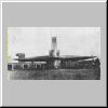
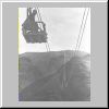
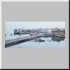
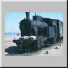
The Massawa port switch engine. |
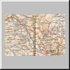
Map and altitudes of the railway between Mai Hizni and Arbaroba. |
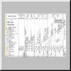
Profile of Asmara-Massawa Railroad. |
Riding over the heights of the Eritrean valleys. |
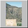
A counterweight pit remaining in the late '60s near Asmara. |
A counterweight pit remaining in the late '60s near Asmara. |
A counterweight pit remaining in the late '60s near Asmara. |
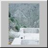
Bases and cuts in the ridges looking west from two places above Nefasit. |
Bases and cuts in the ridges looking west from two places above Nefasit. |
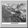
Muscle power. |
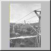
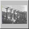
The tramway route. |
A view of the Mt. Codemas span below Asmara. |
Trestle towers above Nefasit. |
Simple towers. |
Trestle towers with dual counterweights. |
Protective cover over railroad and trestle towers with dual counterweights. |
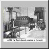
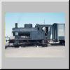
A 150 horsepower Tosi diesel engine in the Nefasit station. |
Cables and towers still in place above Nefasit in early 1960s. |
Only bases left above Nefasit in 1969. |
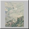
Looking west from above Nefasit towards Asmara in
1969. |
A Keren mosque. |
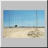
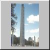
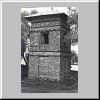
U. S. Army antennae of Stonehouse. |
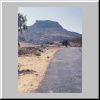
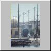
Leaving the city for the country. |
Ad Nefas north of Asmara. |
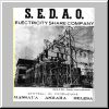
S.E.D.A.O. advertisement. |
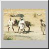
Turning the soil the old fashioned way. |
A euphorbia candelabra. |
The escarpment at 58 Km. |
Elaboret. |
Another view of Elaboret with an Ethiopian Army column coming up the road. |
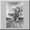
Baobab tree near Keren. |
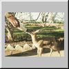
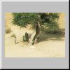
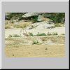
Feeding the Keren Rest Center gazelle. |
The Rest Center bar. |
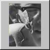
John's chameleon. |
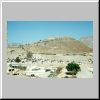
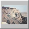
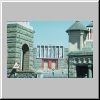
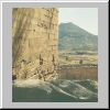
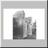
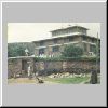
Keren's fortress from the east. |
Keren's fortress from the south. |
Looking north from the hotel. |

The markets. |
The road back to Asmara. |
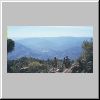
Looking southwest from the hotel. |

A silversmith at work. |
The camel market on an off day.
|
Car sitting in a station on the Asmara-Keren line. |
Kids gather as the littorina is about to leave Kagnew. |

Looking down the track across the plateau toward Keren. |
Looking towards Asmara along tracks. |
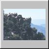
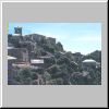
A village on a mountain. |

A well gathering. |
Waiting. |
Traveling. |
A bridge along the way. |
The Anseba River. |
The boys stop to wave. |
Taking in the shade. |

A siding and station. |

The departing third class train. |
Ato (Mr.) Flagger. |
Passing the third class train. |

A man and boy waiting at a station. |
A pump from antiquity still in use. |
A girl waves from behind a rock. |
A homestead. |
Volcanic dikes on the Asmara plain south of Asmara. |
Coptic crosses of Lalibella similar to crosses found on the top of many churches. |
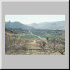
Looking southeast from the road north of Decamere. |
A promotional picture of an earlier Decamere, taken no later than 1952. |
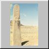
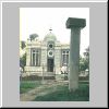
A monument set up by Axumite King Sembrouthes. |
Preparing the fields near a Fever tree. |
A wonderful Fever tree on the back of a modern Eritrean five nakfa note. |

Takonda today. |
Takonda columns. |
Plowing in the town square? |
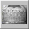
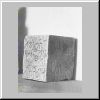
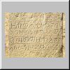
Kaskase altar or statue base with South Arabian inscription. |
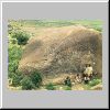
Senafi amba. |
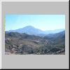
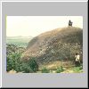
Mt. Matara and valley. |
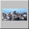
Senafi's fields and town during the dry season. |
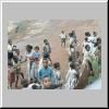
Market day in Senafi. |
A town south of Senafi. |

A border fort. |
A closer look. |
Tigrean and Eritrean road markers. |
The headwaters of the Mareb River. |
Looking off the escarpment toward the Danakil Depression. |
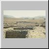
Panorama of the Matara excavation field. |
Matara stele found below the cliff visible in the background. |
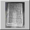
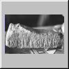
Stele inscription in early Ge'ez. |
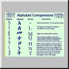
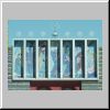
Sample South Arabian ("Sabean"), Ethiopic, and Roman Characters. |
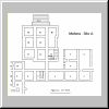
Site A wall plan. |
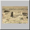
Matara Site C walls looking east. |
Site A (?) wall with Mt. Matara in the background. |
Matara Site D entrance. |
Entrance to excavated Matara church. |
Looking east from Site E over Site B to the Church site. |
Looking northeast from about the same place on Site E. |
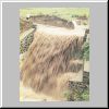
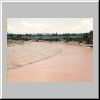
Red-brown, soil-laden water boils over a concrete causeway. |

The road looked like a ribbon on its way up Mt. Alegua. |
Canyon lands from the top of the pass. |
Several switchbacks quickly dropped us down a steep cliff face. |
The switchbacks from below. |
Debra Damo from the road. |
Enticho in mid-day. |
Bus heading south from Gura. For Enticho? |
Looking north towards Yeha from the road. |
Ancient Coptic crosses on a series of stamps. |
Ibexes grace a frieze on a Yeha Church. |
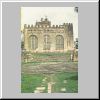
Our first view of the temple of Alumqa in Yeha. |
A closer view of the ancient South Arabian temple of Alumqa and the Coptic church. |
The temple's finished interior. |
Southern base of the mortarless temple wall looking east. |
The Temple of Alumqa. Several views from front and back. |
Onlookers at a photographic event. |

The frieze inscription Bruce is photographing in the previous picture. |
Two views of another piece of this Yeha frieze. |
The name of the moon God, Alumqa, in Sabean. |
Axum today, yesterday, and 1000 years ago! |
Kaleb's early fourth century stele proclaiming his deeds with a closeup of some of the text. |
Ezana's pre-Christian and Christian coins. |
Axum tourist tax receipt for two of us. |
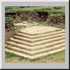
The stelae of Axum. |
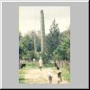
Looking up the tallest standing stele. |

Abune Teclehaimanot School in Asmara
built in Axumite monkey-head style. |
Looking "up" fallen stele, the largest of them all. |
Altar bowls on the base of a fallen stele. |
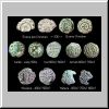
Some Axumite coins - the dates of many kings are still only guesses. |
Some Ethiopian stamps with Axumite coins on them. |
Mai Shum, the Queen of Sheba reservoir
in February in the dry season. |
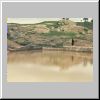
The same reservoir in August after the summer rains. |
Ruins of tombs of Kings Kaleb and Gebra Maskel. |

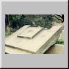
Kaleb's tomb entrance. |
Steps up to the floor of the ruined tomb building. |
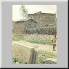
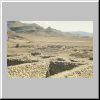
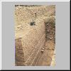
Modern buildings and an ancient pillar base. |

Mug shot at an ancient palace's doorway. |
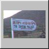
Sign announcing ruins as "Sheba's Palace." |
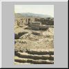
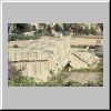
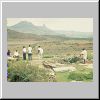
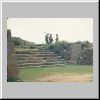
Some excavated ruins of the Queen of Sheba's palace. |
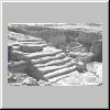
A grand ceremonial stairway. |
What's left of a less grand stairway. |
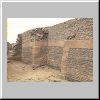
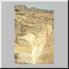
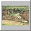
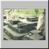
An well preserved, excavated wall. |
Another well preserved, excavated wall. |
Several layers of walls. |
St. Mary's of Zion. |
The Treasury. "Home of the Arc of the Covenant." |

Stone thrones or statue bases? |
Were these bases or ceremonial seats or bases for long lost statues? |
The powerful and graceful lioness of Gobedura. |
The lioness again with Axum in the distance. |
Beggars outside Enda Arbate Ensesa. |
St. Mary of Zion through the stelae. |

An Selassie gate house.
|

Another Enda Selassie gate house. |
An Enda Selassie bell tower. |
A Champagne pot draining outside a sua beit. |

Freshly bottled Champagne. |
Chicken bargaining in full swing. |
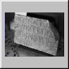
South Arabian text on an Adowa tea house stone. |
Adowa mountains during a rain. |
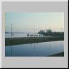
Mareb River in the dry season. |
Mareb River with half its rainy-season capacity. |

Digging for water in a very dry Mareb River. |
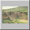
View from the Adi Kwala escarpment. |
The Adi Kwala basalt cliffs. |
Hibret's pictures of "ball of fire" destruction. |
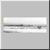
A clam Massawa morning in early 1968. |
Prickly Pears loaded with beles. |
Dogali river bridge. |
West of the road the railroad bridge crosses the almost always dry Dogali river. |
Saline de Massawa's salt pans. |
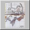
Massawa as seen on this old Italian map. |
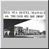
Our hotel - the Army TTU. |
Red Sea Hotel from a Sesante magazine ad. |
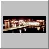
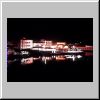
The Savoia Hotel glows in its night lights. |

A typical back-street balcony. |
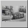
Port switch engine directly across from my coffee table under the Savoia's roofed walkway. |
The same switch engine from a little closer. |
The engine is putting some effort. |
The task is easier once the train gets moving. |
Passers-by on the causeway leading from Massawa. |
The Massawa-Talud causeway and
Massawa city offices on Talud Island. |
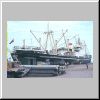
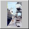
Russia's Sudazha in port. |
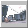
Workers posing in front of their bags on train cars. |
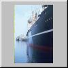
Looking down the other side of these same ships revealed a calm port. |
And the Israelis were too. |
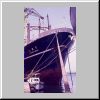
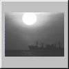
A year later the Hikone Meru was in port from Japan. |

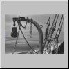
Around the same time I was intrigued by this rigging and crane mess. |
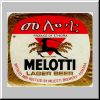
A golden label from a Melotti beer bottle. |
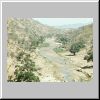
Gurgussum Beach at high tide. |

Gurgussum Beach at low tide. |
A desert walk back from the beach. |
The Massawa theater district complete with roofless movie house. |
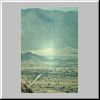
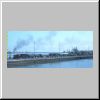
Massawa in the morning. |

Massawa recedes. |
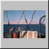
Home for five days. |
Sunset. |
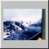
The water was smooth as glass. |
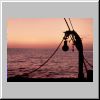
A ship passed to our west. |
An unneeded anchor in a sea of glass. |
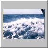
We struggled through the sea. |

We struggled through the sea. |
We struggled through the sea. |
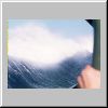
We struggled through the sea. |
Tiran Island through our rigging. |
The Sinai and the Sharm El Sheikh fort at the Strait of Tiran. |

Nearby Aqaba, Jordan, on the far side of the golf from Elath, Israel. |
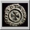
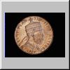
Ezana's Axumite coin. |
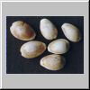
Cowrie shells. |
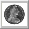
Maria Theresa Thaler. |
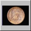
Menelik's dollar. |
Menelik's reverse with more fitting lion. |

Defaced dies fill a need. |
50 Centesimi, 1/10th bir, 1/10th rial. |
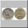
Haile Selassie's 50 matonya. |
Italy's re et imp (king and emperor) coins. |

East African ten cents. |
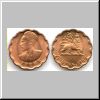
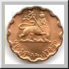
Haile Selassie's scalloped 25-cent coins. |
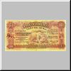
1933 Bank of Ethiopia $2. |
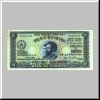
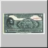
1933 Bank of Ethiopia $5. |
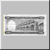
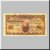
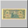
1932 Bank of Ethiopia $10. |
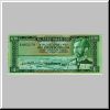
1933 Bank of Ethiopia $50. |

East African Currency Board 5 shillings. |
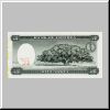
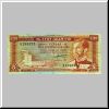
1946 State Bank of Ethiopia $5. |

1961 State Bank of Ethiopia $10 with Massawa. |
1961 National Bank of Ethiopia $1 with Massawa. |
1961 National Bank of Ethiopia $5 with Addis Ababa Airport. |